Personalization
In the Personalization tab, you can customize how information is displayed in the system:
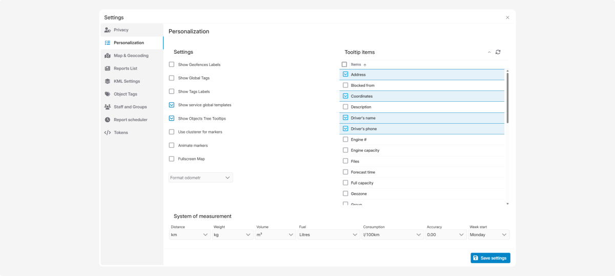
These settings help you personalize the interface. You can choose how information appears on the map and in other UI elements.
Available display options:
-
Show geofences labels — displays text labels with geofence names on the map
-
Show global tags — display tags shared across all users for sorting object information
-
Show tags labels — display additional tags on objects
-
Show global service templates — display shared maintenance templates available to all users
-
Show object tree tooltips — enable hover tooltips when pointing to objects in the list
-
Show LRS Range — displays the accuracy radius when location is determined via LBS (cell towers).
-
Use clusterer for markers — group nearby objects to make the map easier to read
-
Marker animation — add motion to icons on the map
-
Fullscreen map — display the map in full-screen mode
How to configure:
-
In the Personalization tab, find the Settings section2. Review the list of options3. Check the boxes for the options you want to enable
4. Click Save settings in the Personalization tab
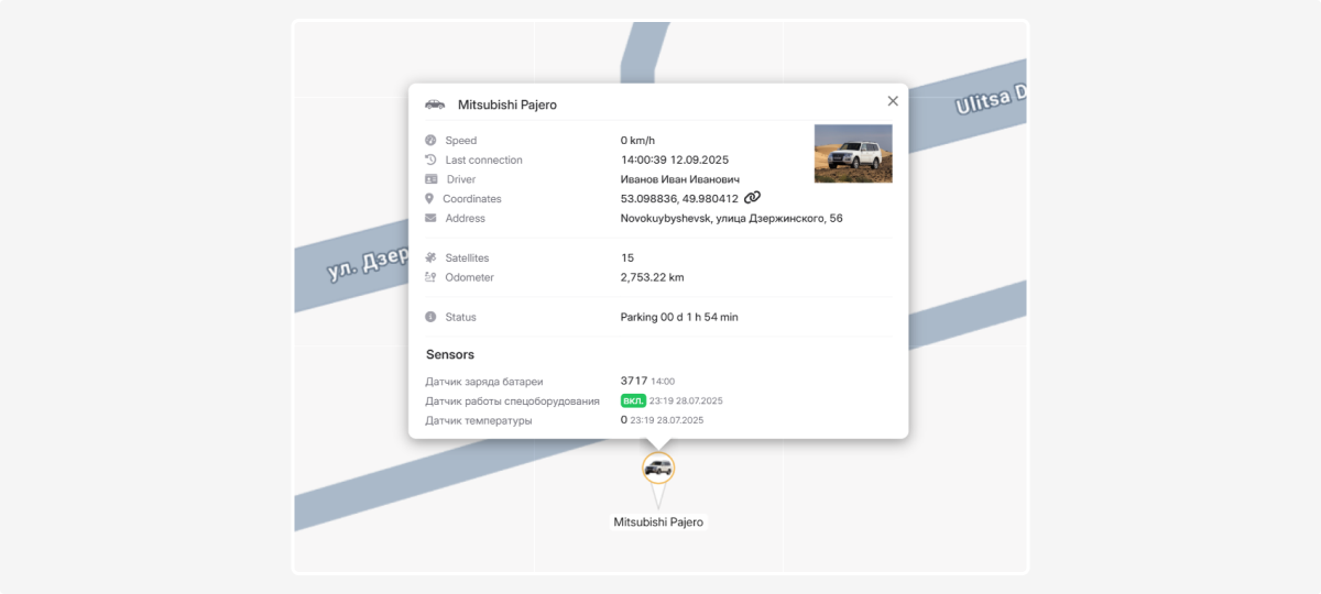
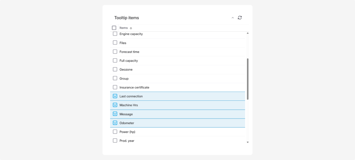
In the Tooltips items section, you can choose what additional information appears when you hover over an object icon on the map.
How to configure:
-
In the Personalization tab, locate the Tooltip items and Tooltip extra items sections
2. Select the elements you need — check the corresponding boxes
3. Click Save settings in the Personalization tab
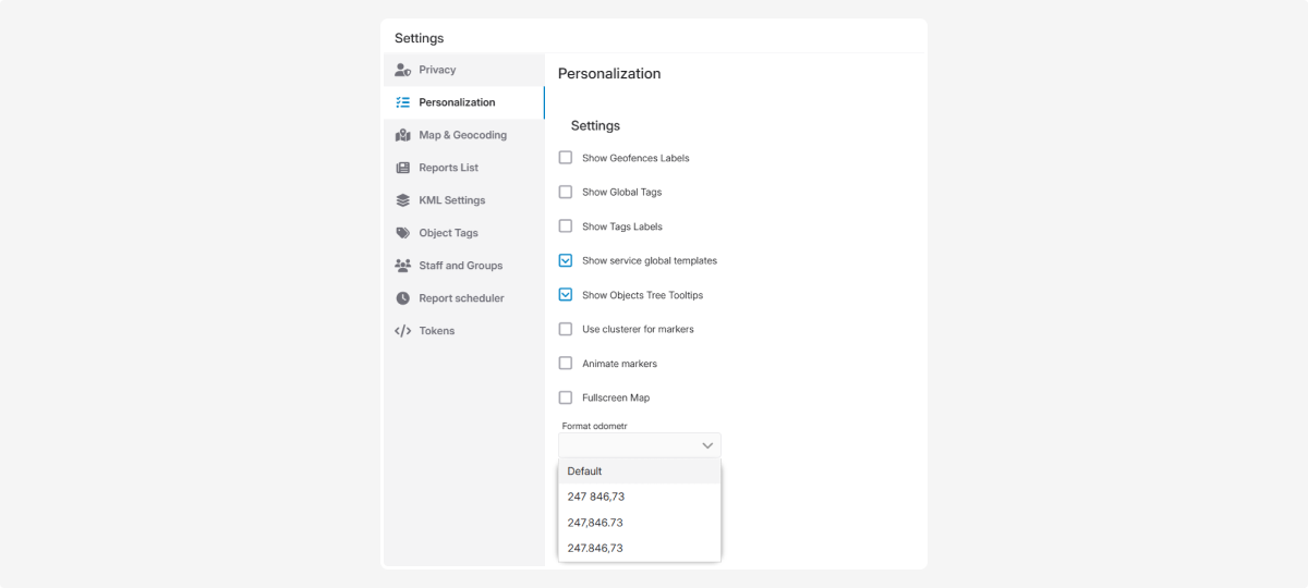
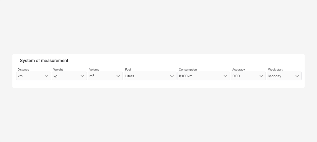
Here you can set:
-
Measurement system:
-
Metric: kilograms, liters, kilometers
-
Imperial: pounds, gallons, miles2. Number format
3. The first day of the week for the calendar and reports
How to configure:
-
In the Personalization tab, find the System of measurement section
2. Choose the desired options from the dropdowns
3. Click Save settings in the Personalization tab
Now all data will be shown in the format you prefer, and the calendar and reports will match your work schedule